
Water Resources
The main objective of the study is to carry out the impact assessment of watershed implementation Programme (WDC-PMKSY 2.0) projects using geospatial technologies by comparing the pre and post dated satellite Data using on screen interpretation and estimation of increase / decrease in the Vegetation Vigour using NDVI techniques.
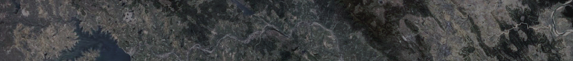
The project envisages carrying out the impact assessment of WDC-PMKSY 2.0 watersheds programme by comparing the pre and post dated satellite data using on screen interpretation using Bhuvan web services and Mobile App. By processing of high resolution satellite data – LISS‐IV and Cartosat, the evaluation report will be generated covering LULC maps, assessment of Drishti photographs and field level activities and estimation of increase / decrease in the Vegetation Vigour using NDVI techniques. There are 35 watersheds in Telangana state. The watersheds have to be monitored for Pre, Mid and Post project stages during 2021-22 to 2028-29 The acquisition of satellite data (Sentinel / Cartosat / LISS IV) and its utilization for the 2021-2022 and 2024-2025 periods are completed for three seasons i.e.
- Kharif (July to October)
- Rabi Season (November to February) and
- Zaid season (March -May )
The mapping work for pre and mid periods is in progress
The following are the list of watershed projects being monitored:|
Sl No |
District |
Block |
Project Name |
Area (Ha) |
|
1 |
Adilabad |
Gadiguda |
Adilabad-WDC- 1 /2021-22 |
4958 |
|
2 |
Adilabad |
Talamadugu |
Adilabad-WDC- 2 /2021-22 |
4877 |
|
3 |
Bhdrdri Kothgudem |
Allapally |
Bhadradri Kothagudem-WDC- 1 /2021-22 |
3496 |
|
4 |
Bhdrdri Kothgudem |
Gunala |
Bhadradri Kothagudem-WDC- 2 /2021-22 |
3504 |
|
5 |
Bhdrdri Kothgudem |
Gunala |
Bhadradri Kothagudem-WDC- 3 /2021-22 |
4776 |
|
6 |
Bhdrdri Kothgudem |
Laxmidevipally |
Bhadradri Kothagudem-WDC- 4 /2021-22 |
4919 |
|
7 |
Jangaon |
Ghanpur (Stn.) |
Jangoan-WDC- 1 /2021-22 |
4992 |
|
8 |
Jayashankar Bhupalapally |
Malharrao |
Jayashankar Bhupalapally-WDC- 3 /2021-22 |
4354 |
|
9 |
Jayashankar Bhupalapally |
Palimela |
Jayashankar Bhupalapally-WDC- 1 /2021-22 |
3939 |
|
10 |
Jayashankar Bhupalapally |
Regonda |
Jayashankar Bhupalapally-WDC- 2 /2021-22 |
4220 |
|
11 |
K.B. Asifabad |
Asifabad |
Kumuram Bheem Asifabad-WDC- 4 /2021-22 |
2860 |
|
12 |
K.B. Asifabad |
Jainoor |
Kumuram Bheem Asifabad-WDC- 2 /2021-22 |
3260 |
|
13 |
K.B. Asifabad |
Kermeri |
Kumuram Bheem Asifabad-WDC- 3 /2021-22 |
3619 |
|
14 |
K.B. Asifabad |
Lingapur |
Kumuram Bheem Asifabad-WDC- 1 /2021-22 |
3513 |
|
15 |
Khammam |
Enkoor |
Khammam-WDC- 1 /2021-22 |
4974 |
|
16 |
Mahabubnagar |
Gandeed |
Mahabubnagar-WDC- 2 /2021-22 |
4153 |
|
17 |
Mahabubnagar |
Hanwada |
Mahabubnagar-WDC- 1 /2021-22 |
4056 |
|
18 |
Mancherial |
Jaipur |
Mancherial-WDC- 2 /2021-22 |
4993 |
|
19 |
Mancherial |
Kasipet |
Mancherial-WDC- 1 /2021-22 |
4950 |
|
20 |
Medak |
Tekmal |
Medak-WDC- 1 /2021-22 |
3459 |
|
21 |
Nagarkurnool |
Amrabad |
Nagarkurnool-WDC- 1 /2021-22 |
2548 |
|
22 |
Nalgonda |
Devarakonda |
Nalgonda-WDC- 1 /2021-22 |
4971 |
|
23 |
Nirmal |
Mamada |
Nirmal-WDC- 2 /2021-22 |
4131 |
|
24 |
Nirmal |
Sarangapur |
Nirmal-WDC- 1 /2021-22 |
4258 |
|
25 |
Nizamabad |
Sirikonda |
Nizamabad-WDC- 1 /2021-22 |
4850 |
|
26 |
Nizamabad |
Varni |
Nizamabad-WDC- 2 /2021-22 |
4060 |
|
27 |
Rajanna Sircilla |
Gambhiraopet |
Rajanna Sircilla-WDC- 2 /2021-22 |
3122 |
|
28 |
Rajanna Sircilla |
Yellaredipet |
Rajanna Sircilla-WDC- 1 /2021-22 |
2838 |
|
29 |
Rangareddy |
Manchal |
Ranga Reddy-WDC- 1 /2021-22 |
4346 |
|
30 |
Sangareddy |
Kohir |
Sangareddy-WDC- 1 /2022-23 |
4733 |
|
31 |
Siddipet |
Chinnakodur |
Siddipet-WDC- 1 /2021-22 |
4803 |
|
32 |
Suryapet |
Jajireddygudem |
Suryapet-WDC- 1 /2021-22 |
4253 |
|
33 |
Vikarabad |
Vikarabad |
Vikarabad-WDC- 1 /2021-22 |
4998 |
|
34 |
Warangal |
Raiparthy |
Warangal Rural-WDC- 1 /2021-22 |
4618 |
|
35 |
Yadadri Bhuvanagiri |
Narayanpur |
Yadadri Bhuvanagiri-WDC- 1 /2021-22 |
4285 |


Objective :
Creation of spatial database on Waterbodies information system with respect to encroachment
Description :
The Waterbodies belonging to Telangana state are being mapped by making use of Cadastral (Before 1940s), Toposheets (1940s to 1970s) and updation of new tanks and status of encroachment using temporal satellite data of 2014 and 2023 years.
The encroachment status during 2014 and 2023 years are classified as below:
- Built-up – Partial/Total Encroached
- Agriculture use -Partial /Total
- Total submerged in big Reservoir
This information will be useful to take further remedial measures and protection of Waterbodies


Objective :
Village-wise rain water harvesting plan for ground water recharge at micro watershed levels in problematic villages (OE & Critical areas) of Telangana State
Description :
- Mapping of existing Water bodies / Recharge Structures and hydrogeological parameters which control the ground water recharge in the village.
-
Analysis of Rainfall data of the village for
- estimation of run-off yield available for harvesting
- estimation of storage capacity of existing harvesting structures
- estimation of balance yield to be harvested by proposed harvesting structures
- Identification of suitable site-specific ground water recharge structures in the village based on the analysis of given hydrogeological parameters.
Integration of site-specific recharge structures location data with required reference data / respective village cadastral map which displays survey No's for easy identification of the recommended structure on the ground.
